
The Cross Washington Mountain Bike Race starts May 14, in less than two weeks, and spring is sputtering. A persistent snowpack in the Cascade Mountains has already precipitated a re-route of the high country in Troy’s original track to an alternative to the east and lower in elevation. But even that route is being threatened by the cold spring. The nearby snow gauges are consistently showing three feet of snow. Someone needs to get up there and see what is going on.
This is where I come into the picture – I will do anything to get out of town and into my favorite mountain biking destination. Where is the Colockum Wildlife Refuge? Look here between miles 371 and 392.
Cross Washington Mountain Bike Race
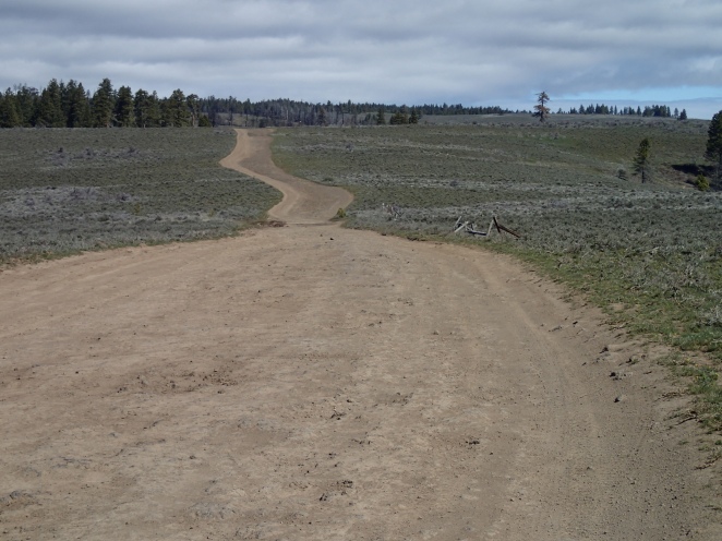
A rare break in the weather provids a two day window of no rain and wind. I drive to the north end of the Wild Horse wind farm and park about where Parke Creek Road intersects the ridgetop Beacon Road. The race route climbs abruptly up Parke Creek from the Kittias flatlands. The roads ahead are a jumbled maze of unmarked intersections and road names appear haphazardly on the outdated maps so follow my track here to get oriented:
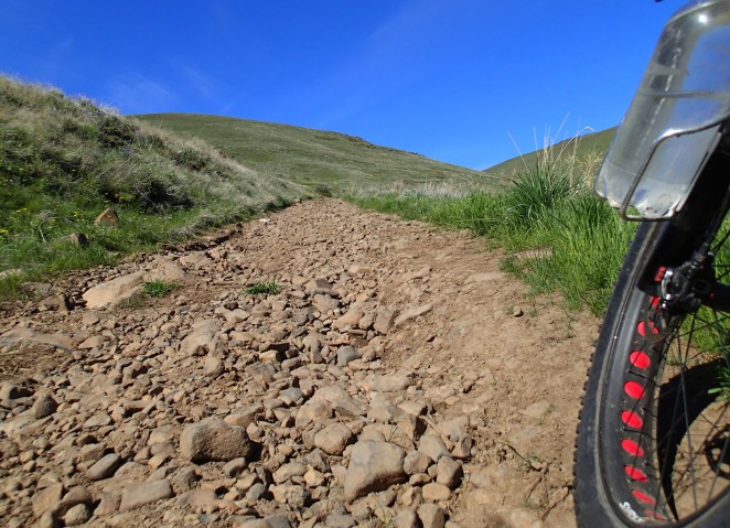
Baby heads embedded in basalt clay are the normal riding surface in this country except when it gets wet and then it is baby heads and slime. Like the off-road drivers who use this area mainly during hunting season, I weave widely to avoid the lingering mud swamps and the worst of the bumps.
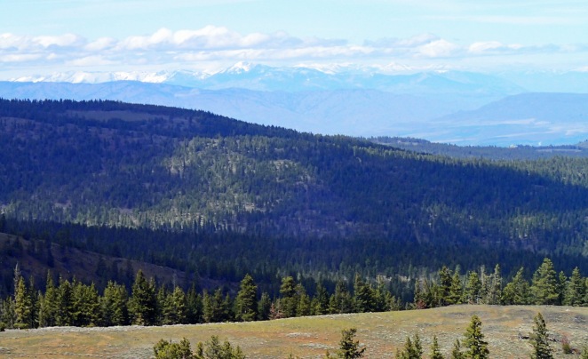
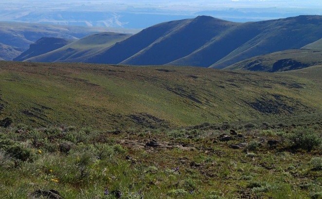
Starting from an elevation of 3600 feet, the road straddles the ridge 7.4 miles for a 1200-foot climb through meadows and scattered pine. To the west is Mt. Rainier and its vanguard of snow-bound peaks. To the east are the steep and treeless canyons dropping off into the Columbia River. Empty space, empty mind.
A right turn at mile 7.4 takes me onto an even bumpier road. The snowpack starts. This is a winter snow machine route so the snow is firm enough to walk on without sinking in much but not firm enough to ride my fat bike. I begin the walk not knowing how much of this was ahead. My hope is that once I got off the northeast aspect the two feet of snow would disappear.

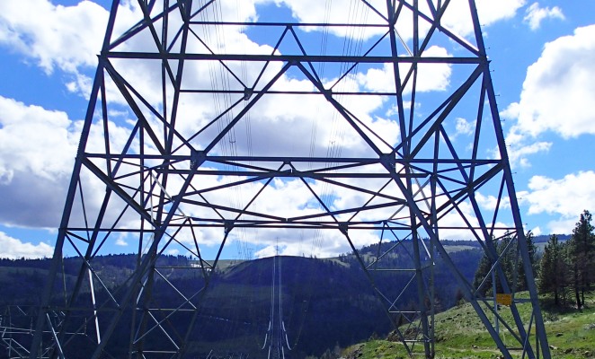
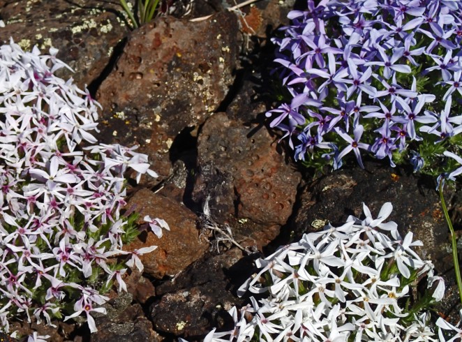
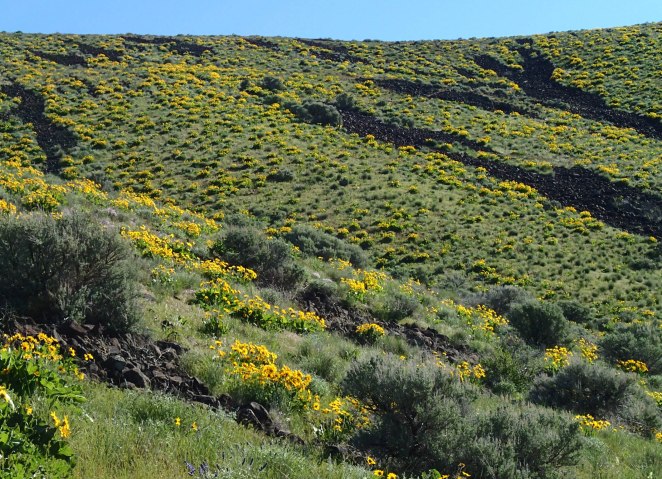
After a mile I reach the power line corridor where the snow is mostly gone from the road. A modest climb following the power lines leads to a broad plateau, recently melted but already showing its colors.

Several hundred elk warily watch me, the two-wheeled predator passing by. The treeless power line corridor provides early browse for them. They look unusually skinny for this time of year and probably suffered from the long and snowbound winter.
A potential Airbnb rental with a delectable view to the east sits on the edge of the corridor. It comes with an outside refrigerator.

The race route intersects Brewton Road 10.9 miles into my ride. Ahead, along the race route, is the 2300-foot plunge down to Tarpiscan, only to be followed by a 1100-foot climb up to Colockum Road. Following Brewton Road to the west negates all that grief so I check out this as an alternative race route. The road follows the contours nicely and has a relatively smooth gravel surface.
But snow conditions go south quickly.

I walk along at a sub-2 mph-pace enjoying the stroll and four miles later I intersect Colockum Road, the main ridge route between Kittias and Wenatchee. But it too is snowed in and so I walk another half mile down Colockum Road. Finally free of snow, I begin the steep bumpy descent and take frequent photo breaks to rest my battered hands and arms. The big tires and front shock aren’t doing their stuff.

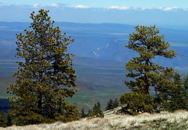
In the distance I catch a glimpse of the Rock Island Grade, a 4.6 mile ribbon of gravel road rising steeply from the east bank of the Columbia River. This is the race route out of Wenatchee.
I intersect the race route where it intersects Colockum Road and decide to ride the race route backwards the 6.4 miles to where I left it at Brewton Road. First the 1100 foot descent and then the 2300 foot climb following the power lines.
High tension power line corridors consume a consider amount of land. At a width of 650 feet that is 7900 acres per 100 miles of power line. They buzz imperceptibly and often go unnoticed because they are high overhead. The towers gleam in the sunlight and provide contrasting angles to otherwise non-linear landscape.
Tarpiscan Creek is the first of four stream crossings and has the most flow. Obviously too large to ride through, I resign myself to wet feet. I position myself upstream of the bike and start across. The big balloon tires turn it into a rubber raft and now I’m in a tug of war with the stream. I refuse to give up my bike and inch the front end to the far shore while the rear end wags back and forth in the current. After a few minutes I win bigly.

The steep chunky climb, often through razor sharp cobbles, continues for five miles and gives me time to re-think about my choice of bike for the upcoming race. A majority of the route is smooth surfaces and my rigid Bandersnatch with a 3-inch-wide tire in front and 2.4 in back is the logical choice. But the 20 miles through the Colockum wildlife refuge is going to feel unbearably harsh on that bike. And then there are those bumpy bits of the John Wayne Trail further east of the Columbia River. The full suspension bike with 3 inch tires instead? I would need to transfer the aero bars to it and that would be quite the sight. I have a week to decide.
After three more stream crossings (two successful ride-throughs and one bobbled) I get to Brewston Road and ponder continuing south along the powerline corridor as an alternative to going back through the snow for a half hour of walking. From my vantage point only a few hundred feet of snow blocks the corridor road so the choice is easy.

It proves delightful with great views to the west once I reach the top. Prancing elk outperform me as I plod by. I intersect Caribou Road and take the one mile jog to the east back to the race route. Wouldn’t this be the better route for the race, Troy?
Now, the most important part of the day — finding that perfect camping spot. It must have good water and a pleasant setting. Firewood would be a plus. Eventually, I come across a spring feeding into a pond infested with lusty frogs. They, along with a pair of courting owls, complete the ambience. I settle in and watch a half moon arc to the west. The campfire is just something to stare into since the night is so warm. Spring has finally arrived.
I’m awaked early by a cacophony of birds and halfway through my second cup of coffee decide on an exploration through unknown terrain, this time to the east. Here is what I settle on:
Brushy Road starts out mild enough. Darting in and out of small drainages on the contour, the early flowers alternate with patches of snow.

After five miles I leave behind the forest and my smooth road. A rough double track leads east along the ridge defining the north edge of the Brushy Creek drainage. Ridgetop roads in this country typically are a hard scrabble of broken basalt chunks with little soil holding them together. The high winds blow the soil away. The dry climate retards rock weathering.
Even the ATVs mostly avoid this route. Just me, the elk, wind turbines to the south, and the open sky.

The route steepens further and the rock ledges become walk-downs. The combination of a loaded bike, tire-slashing rocks, and the fact that no one knows where I am should I need help, nudges me towards the cautious end of my risk scale. The walking just means more pictures to take.

I take the final dive into Brushy Creek canyon, 2500 feet lower than where I had started. Blooming apple trees in the stream bottom go back to a previous century when someone thought this land could be homesteaded. Only bits of metal and the orchard remain.
The road out of the canyon to the south rim is steep, chunky, and rutted. More reasons to walk and empty my mind.

The grove of pines where I left the car comes all too soon and I’m left with the disillusioning drive east on Interstate 90, a world where I don’t always fit in. A stop at the Love’s Truck Stop in Ritzville does further damage to my senses.
But I’ll be back soon to bump along the byways of the Colockum.

Beautifully written and nice photos!
Fabulous Area!
Cold or hot coffee? 😉
I brought a stove! Winnebego bikepacking this time.
Good luck next week! I vote for the full-suspension setup.